The Kunlun 2007 Expedition – August 2007
Below we’ve gathered some information about the mountains climbed for future expeditions. The routes are following:
| Peak | Route | Difficulty | FA Party | Date |
| 6355 Manse | Karagul Gringos | D+, 900m | Henri & Lauri | August 13th, 2007 |
| 6013 God Tang | PMS – Petite Mountain Sickness | D+, 450m | Henri, Kalle, Lauri, Mikko, Rauno, Teemu & Veli-Matti | August 14th, 2007 |
| 6046 Ye-Zi | A Man Who Dances Like a Tibetan | TD-, 900m | Henri & Lauri | August 22nd, 2007 |
| 6045 Lacio | Island Couloir | AD, 900m | Mikko, Rauno & Veli-Matti | August 23rd, 2007 |
The expedition website is located at www.kunlun2007.fi. We’ve also prepared Google Earth locations available for download here

The Kunlun Moutains are situated in the western corner of the Xinjiang province in China
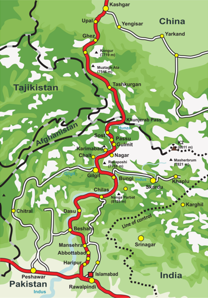
Here is a map with Karakoram Highway. The Mountains belong to the southern parts of Mustagh Ata massif.
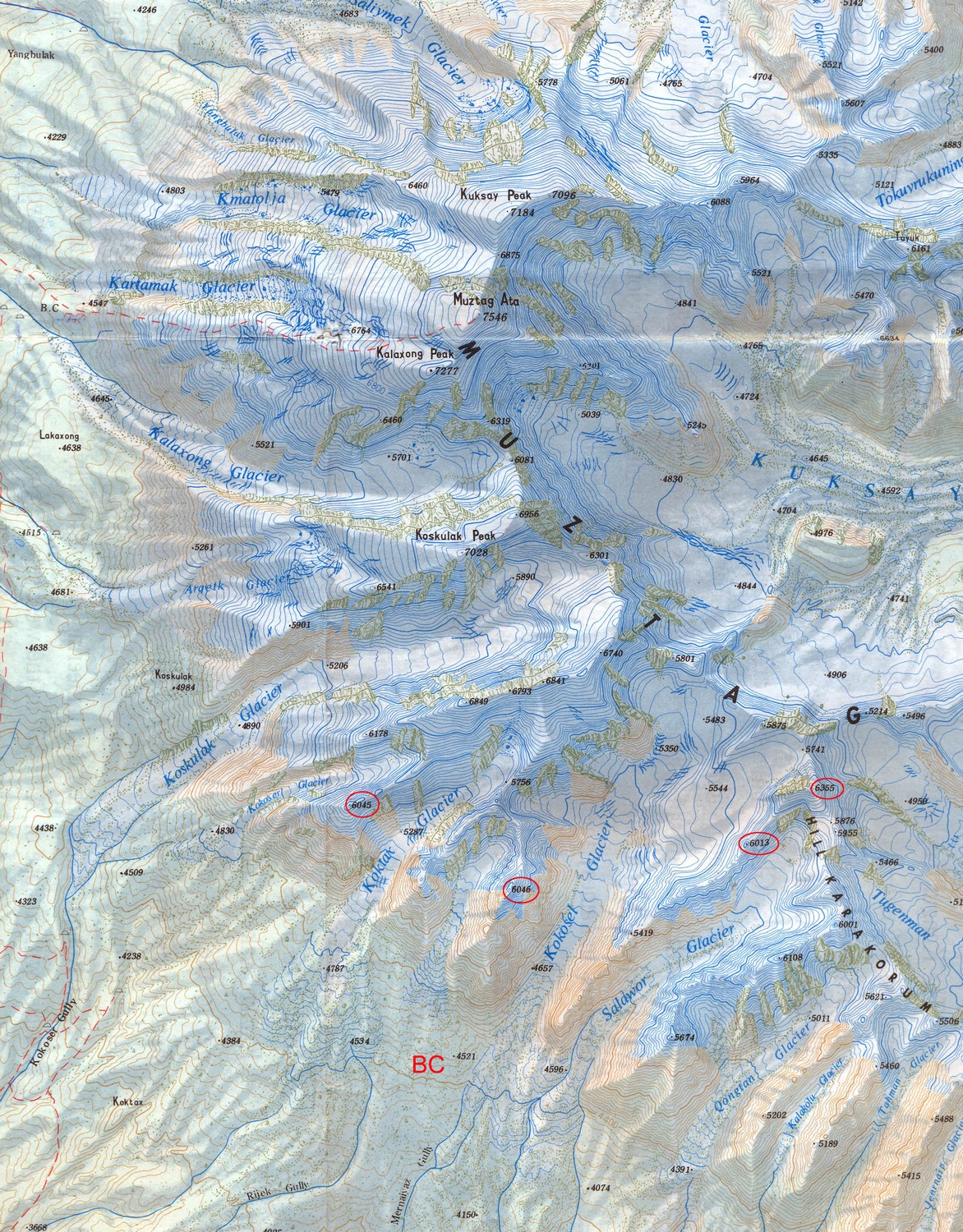
Topographical map of the area – click map for larger resolution